View & Download Uttarakhand Map Download
|
|
Uttarakhand Map – You can download the map of Uttarakhand as a PDF for free. You can use this map for educational and non-commercial purposes.
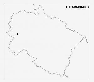
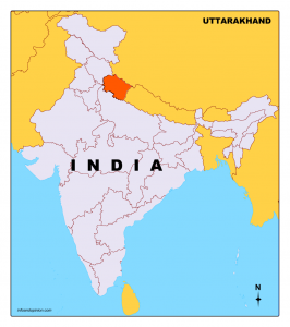
Uttarakhand was formed as the 27th state of India on 9 November 2000, when it was carved out of northern Uttar Pradesh. Situated in the foothills of the Himalayan mountain ranges, it is largely a hilly state with international borders with China (Tibet) in the north and Nepal in the east. In its north-west lies Himachal Pradesh, while in the south is Uttar Pradesh. Dehradun is the capital of Uttarakhand.
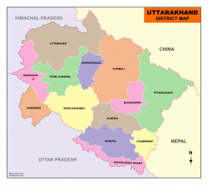
Uttarakhand is divided into 13 districts under two administrative divisions named Garhwal and Kumaon
Uttarakhand Map
List of Districts in Uttarakhand
| Division | S.No. | Code | District | Headquarters | Population | Area (km²) |
|
Garhwal
|
1 | CL | Chamoli | Gopeshwar | 391,114 | 8,030 |
| 2 | DD | Dehradun | Dehradun | 1,695,860 | 3,088 | |
| 3 | HA | Haridwar | Haridwar | 1,927,029 | 2,360 | |
| 4 | PG | Pauri Garhwal | Pauri | 686,572 | 5,399 | |
| 5 | RP | Rudraprayag | Rudraprayag | 236,857 | 1,890 | |
| 6 | TG | Tehri Garhwal | Tehri | 616,409 | 4,080 | |
| 7 | UT | Uttarkashi | Uttarkashi | 329,686 | 8,016 | |
| Kumaon | 8 | AL | Almora | Almora | 621,972 | 3,083 |
| 9 | BA | Bageshwar | Bageshwar | 259,840 | 2,302 | |
| 10 | CP | Champawat | Champawat | 259,315 | 1,781 | |
| 11 | NA | Nainital | Nainital | 955,128 | 3,860 | |
| 12 | PI | Pithoragarh | Pithoragarh | 485,993 | 7,100 | |
| 13 | US | Udham Singh Nagar | Rudrapur | 1,648,367 | 2,908 |
2 Comments